


| North Facing Camera Click On Play Button To View Live Image |
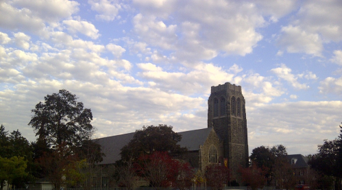
Sky Facing Camera Click On Image To View Full Screen In New Window 
|


Mid-Atlantic Weather Network
MAWN
|
Temperature [ F° ]
Dew Point [ F° ]
Humidity [ % ]
Wind [ mph ]
Rain Today [ in ]
Pressure [ inHg ]
Fire Danger [Chandler Burning Index]
|
[![]() ] Weather, WebCam, Lightning,
[
] Weather, WebCam, Lightning,
[![]() ] Weather, Lightning,
[
] Weather, Lightning,
[![]() ] Weather, WebCam,
[
] Weather, WebCam,
[![]() ] Weather
Cluster - click to expand details
] Weather
Cluster - click to expand details
Conditions data shown was collected
from 2024-04-25 15:31:48 EDT to 2024-04-25 16:32:12 EDT
Regional mesonet-map script by Saratoga-Weather.org
Current Conditions
Conditions data shown was collected
from 2024-04-25 15:31:48 EDT to 2024-04-25 16:32:12 EDT
Note: Click on the table column title to change the order of that column's vaues.
Area |
Station |
Current Cond. |
Temp. °F |
Dew Point °F |
Humid % |
Wind mph |
Gust mph |
Rain in |
Pressure in |
Trend | Fire Danger |
Last Update |
||
|---|---|---|---|---|---|---|---|---|---|---|---|---|---|---|
| Maryland | Bel Air | 56 | 42 | 59 | S |
0 | 0.00 |
|
Steady | Low | 16:31:58 | |||
| Maryland | Damascus | 62 | 59 | 90 | S |
15 | 0.00 |
|
Steady | Low | 16:31:41 | |||
| Maryland | Elkton | 58 | 42 | 56 | ENE |
1 | 0.00 |
|
Steady | Low | 16:32:02 | |||
| Maryland | Halethorpe | 59 | 43 | 56 | SE |
2 | 0.00 |
|
Steady | Low | 16:32:00 | |||
| Maryland | Hillcrest Heights | 58 | 44 | 58 | NNE |
3 | 0.00 |
|
Falling Slowly | Low | 15:31:48 | |||
| Maryland | Lexington Park | 58 | 46 | 63 | SE |
0.00 |
|
Steady | Low | 16:28:03 | ||||
| Maryland | Perry Hall | 57 | 43 | 60 | ENE |
2 | 0.00 |
|
Steady | Low | 16:32:05 | |||
| Maryland | Thurmont | 57 | 40 | 53 | SE |
3 | 0.00 |
|
Steady | Low | 16:31:58 | |||
| New Jersey | Hasbrouck Heights | 55 | 30 | 38 | SSE |
2 | 0.00 |
|
Steady | Low | 16:32:01 | |||
| New Jersey | Morris Plains | 59 | 23 | 25 | NE |
1 | 0.00 |
|
Steady | Moderate | 16:32:05 | |||
| New Jersey | Succasunna | 56 | 23 | 27 | SSW |
0.00 |
|
Steady | Moderate | 16:32:09 | ||||
| New Jersey | Wood Ridge | 57 | 32 | 39 | SSE |
7 | 0.00 |
|
Steady | Low | 16:32:05 | |||
| Pennsylvania | Allentown | 57 | 35 | 43 | NW |
1 | 0.00 |
|
Steady | Low | 16:32:06 | |||
| Pennsylvania | Archbald | 62 | 22 | 21 | SSE |
4 | 0.00 |
|
Steady | High | 16:32:05 | |||
| Pennsylvania | Atglen | 57 | 39 | 51 | SSW |
5 | 0.00 |
|
Steady | Low | 16:32:04 | |||
| Pennsylvania | Hanover Township | 63 | 27 | 26 | N |
0 | 0.00 |
|
Steady | Moderate | 16:15:23 | |||
| Pennsylvania | Lake Wynonah | 57 | 39 | 51 | ENE |
0 | 0.00 |
|
Steady | Low | 16:32:08 | |||
| Pennsylvania | Punxsutawney | 58 | 33 | 39 | SSW |
7 | 0.00 |
|
Steady | Low | 15:52:06 | |||
| Pennsylvania | Smethport | 56 | 29 | 35 | N |
10 | 0.00 |
|
Steady | Low | 16:25:10 | |||
| Pennsylvania | Thornhurst | 56 | 26 | 32 | NW |
4 | 0.00 |
|
Steady | Low | 16:32:08 | |||
| Pennsylvania | Willow Street | 58 | 37 | 46 | NNW |
0.00 |
|
Falling Slowly | Low | 16:28:29 | ||||
| Virginia | Chesapeake | 54 | 48 | 81 | NE |
10 | 0.00 |
|
Steady | Low | 16:32:11 | |||
| Virginia | Chesapeake-2 | 52 | 47 | 81 | NE |
10 | 0.00 |
|
Steady | Low | 16:32:10 | |||
| Virginia | Chesterfield | 65 | 51 | 61 | N |
2 | 0.00 |
|
Falling Rapidly | Low | 16:32:11 | |||
| Virginia | Clifton | 61 | 46 | 58 | ESE |
3 | 0.00 |
|
Steady | Low | 16:31:50 | |||
| Virginia | Lexington | 32 | -170 | 0 | N |
0 | 0.00 |
|
Steady | n/a | 16:32:12 | |||
| Virginia | Whitetop | 69 | 66 | 91 | W |
0 | 0.00 |
|
Steady | Low | 16:32:12 | |||
| Virginia | Willowsford Farm | 60 | 43 | 53 | N |
4 | 0.00 |
|
Steady | Low | 16:32:05 | |||
| West Virginia | Charles Town | 59 | 41 | 51 | E |
5 | 0.00 |
|
Steady | Low | 16:31:09 |
Stations Features
- Maryland
- Bel Air [ Weather, WebCam ]
- Damascus [ Weather ]
- Elkton [ Weather ]
- Halethorpe [ Weather, WebCam, Lightning ]
- Hillcrest Heights [ Weather ]
- Lexington Park [ Weather, Lightning, Webcam ]
- Perry Hall [ Weather, WebCam ]
- Thurmont [ Weather, Webcam ]
- New Jersey
- Hasbrouck Heights [ Weather ]
- Morris Plains [ Weather, WebCam ]
- Succasunna [ Weather, WebCam ]
- Wood Ridge [ Weather, WebCam ]
- Pennsylvania
- Allentown [ Weather ]
- Archbald [ Weather, WebCam ]
- Atglen [ Weather ]
- Hanover Township [ Weather, WebCam ]
- Lake Wynonah [ Weather ]
- Punxsutawney [ Weather ]
- Smethport [ Weather, WebCam ]
- Thornhurst [ Weather ]
- Willow Street [ Weather ]
- Virginia
- Chesapeake [ Weather, WebCam ]
- Chesapeake-2 [ Weather, WebCam, Lightning ]
- Chesterfield [ Weather, WebCam ]
- Clifton [ Weather, WebCam, Lightning ]
- Lexington [ Weather ]
- Whitetop [ Weather ]
- Willowsford Farm [ Weather, WebCam ]
- West Virginia
- Charles Town [ Weather, Webcam ]
Regional Mesonets
- Africa
- Namibia Weather Network (NAMWN) Stations in Namibia
- Canada
- Canadian Atlantic Weather Network (CAWN) Stations in E-QC,NB,NS,PE,NL
- Ontario Weather Network (COWN) Stations in ON,W-QC
- Quebec Weather Network (CQWN) Stations in E-ON,QC,NB,NS
- Saskatchewan Weather Network (CSKWN) Stations in SK
- Western Canada Weather Network (WCWN) Stations in BC,AL
- Europe
- Austria Weather Network (ATWN) Stations in Austria
- Benelux Weather Network (BNLWN) Stations in Belgium, Netherlands, Luxembourg
- Czech Republic Weather Weather Network (CZWN) Stations in Czech Republic
- European Weather Network (ZEUR) Stations in Europe
- Germany Weather Network (DEWN) Stations in Germany
- Hellas Meteo Network (GRWN) Stations in Greece
- Iberian Peninsula Weather Network (IPWN) Stations in Spain, Portugal, Andorra
- Ireland Weather Network (IEWN) Stations in Ireland
- Portugal Weather Network (PTWN) Stations in Portugal
- Slovenia Weather Network (SIWN) Stations in Slovenia
- United Kingdom Weather Network (UKWN) Stations in England, Wales, Scotland, N.I.
- Pacific
- Australian Weather Network (AUWN) Stations in ACT, NSW, NT, QLD, SA, TAS, VIC, WA
- New Zealand Local Weather Network (NZWN2) Stations in North Island, South Island
- USA
- Alaskan Weather Network (AKWN) Stations in AK
- Mid-Atlantic Weather Network (MAWN) Stations in PA, NJ, WV, VA, DE, MD, DC
- Mid-South Weather Network (MSWN) Stations in TX, OK, AR, LA
- Midwestern Weather Network (MWWN) Stations in MN, WI, MI, IA, IL, IN, OH, MO, KY
- Northeastern Weather Network (NEWN) Stations in PA, NJ, NY,CT, RI, MA, VT, NH, ME
- Northwest Weather Network (NWWN) Stations in WA, OR, ID, MT
- Plains Weather Network (PWN) Stations in OK, KS, ND, NE, SD
- Rocky Mountain Weather Network (RMWN) Stations in WY, CO, NM
- Southeastern Weather Network (SEWN) Stations in TN, NC, SC, MS, AL, GA, FL
- Southwestern Weather Network (SWN) Stations in AZ, CA, HI, NV, UT
Regional Networks created by Saratoga-Weather.org along with the Global Afilliated Regional Networks hub site at NorthAmericanWeather.net. [About]
![[WOW]](WOW.gif)
![[Skywarn]](Skywarn.gif)

![[AWEKAS]](AWEKAS.gif)
![[CANWARN]](canwarn.png)
![[Weather Underground PWS IONOSHAW2]](https://dw7240.com/Base-Canada/wunderground.png)

![[WA]](WA.gif)
![[DAVIS]](DAVIS.gif)
![[anything]](ANYTHING.gif)
![[CoCoRaHS]](cocorahs_can.jpg)
![[MADIS]](MADIS.gif)
![[wcloud]](weathercloud.gif)
![[NOAARADIO]](ani-noaa-radio-small.gif)
![[NOAA]](NOAA.gif)
![[wxtogether]](weather_together.jpg)
![[ipcamlive]](IPCamLive.png)
![[ThingSpeak]](thingspeak.png)

![[MESOWEST]](MESOWEST.gif)
![[PWS]](PWS.gif)
![[COWN]](COWN.gif)
![[CWOP]](CWOP.gif)
![[WEATHERBUG]](WEATHERBUG.png)
![[WINDFINDER]](windfinder.gif)
