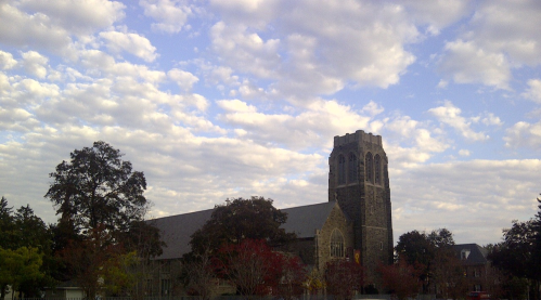


| North Facing Camera Click On Play Button To View Live Image |
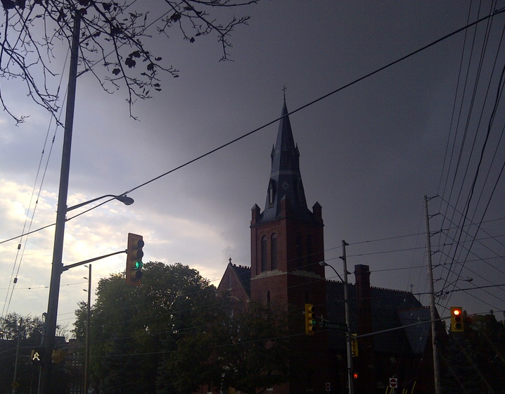
Sky Facing Camera Click On Image To View Full Screen In New Window 
|


River Heights
Last Updated: Saturday April 20th, 2024 03:42 AM EDT
| Stage Color Key | |||||
|---|---|---|---|---|---|
| No Flooding | Near Flood | Minor Flooding | Mod Flooding | Major Flooding | Obs > 24hrs |
| Location | Height | Trend | Forecast | Status | ||
|---|---|---|---|---|---|---|
| Chenango River at Greene (GNEN6) | 5.49ft | Normal | ||||
| Chenango River at Chenago Forks (CNON6) | 5.41ft | Normal | ||||
| Susquehanna River at Binghamton (BNGN6) | 5.62ft | Normal | ||||
| Susquehanna River at Windsor (WSRN6) | 8.18ft | Normal | ||||
| Susquehanna River at Sidney (SIDN6) | 972.23ft | Normal | ||||
| Susquehanna River at Bainbridge (BAIN6) | 7.15ft | Normal | ||||
| Susquehanna River at Unadilla (UNDN6) | 6.07ft | Normal | ||||
| West Branch Delaware at Cannonsville (CNNN6) | 1,151.64ft | Near Flood Stage | ||||
| West Branch Delaware at Walton (WALN6) | 5.77ft | Normal | ||||
| West Branch Delaware at Delhi (DELN6) | 3.49ft | Normal | ||||
| East Branch Delaware at Downsville (DWNN6) | 4.14ft | Normal | ||||
| East Branch Delaware at Pepacton (PEPN6) | 1,280.33ft | Near Flood Stage | ||||
| Unadilla River at Rockdale (RCKN6) | 6.05ft | Normal | ||||
| Snoequalmie River (squw1) | 4.70ft | Normal | ||||
| Unadilla River at Rockdale3 (crtn6) | 4.81ft | Normal | ||||
| Ouleout Creek at East Sidney Dam (ESDN6) | 1,142.26ft | Normal | ||||
Data Courtesy of the Advanced Hydrologic Prediction Service
Script Courtesy of Dennis at East Masonville Weather
![[WOW]](WOW.gif)
![[Skywarn]](Skywarn.gif)

![[AWEKAS]](AWEKAS.gif)
![[CANWARN]](canwarn.png)
![[Weather Underground PWS IONOSHAW2]](https://dw7240.com/Base-Canada/wunderground.png)

![[WA]](WA.gif)
![[DAVIS]](DAVIS.gif)
![[anything]](ANYTHING.gif)
![[CoCoRaHS]](cocorahs_can.jpg)
![[MADIS]](MADIS.gif)
![[wcloud]](weathercloud.gif)
![[NOAARADIO]](ani-noaa-radio-small.gif)
![[NOAA]](NOAA.gif)
![[wxtogether]](weather_together.jpg)
![[ipcamlive]](IPCamLive.png)
![[ThingSpeak]](thingspeak.png)

![[MESOWEST]](MESOWEST.gif)
![[PWS]](PWS.gif)
![[COWN]](COWN.gif)
![[CWOP]](CWOP.gif)
![[WEATHERBUG]](WEATHERBUG.png)
![[WINDFINDER]](windfinder.gif)
