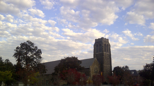


| North Facing Camera Click On Play Button To View Live Image |
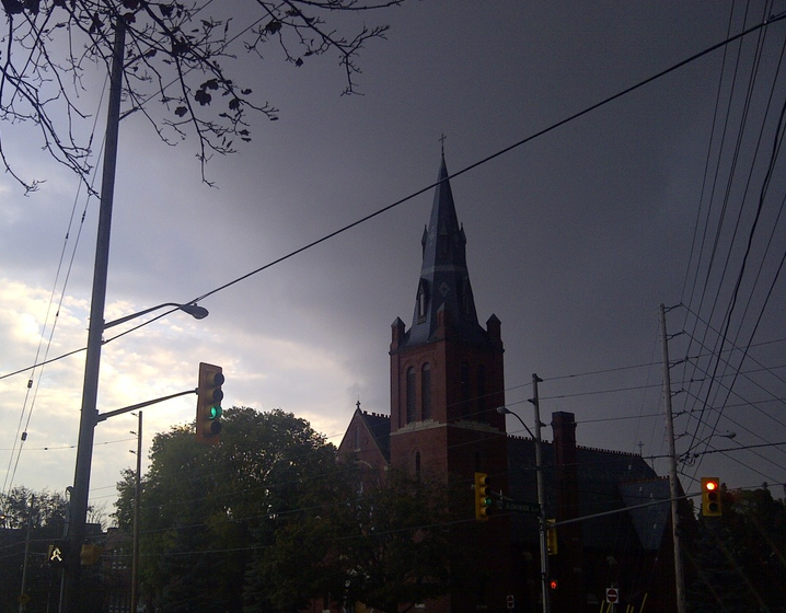
Sky Facing Camera Click On Image To View Full Screen In New Window 
|


| ||||||
| Extended Forecast - Environment Canada | ||||||
| Wednesday
Chance of showers Max: 9°C |
Thursday
Sunny Max: 9°C |
Friday
Sunny Max: 15°C |
Saturday
Chance of showers Max: 14°C |
Sunday
Chance of showers Max: 20°C |
Monday
Chance of showers Max: 18°C |
Tuesday
Cloudy Max: 16°C |
| Wednesday night
Clear Min: -2°C |
Thursday night
Clear Min: -1°C |
Friday night
Cloudy periods Min: 8°C |
Saturday night
Chance of showers Min: 12°C |
Sunday night
Chance of showers Min: 11°C |
Monday night
Chance of showers Min: 10°C |
|
Forecast
Oshawa, ON (Issued: Wednesday April 24, 2024 at 05:00 EDT)
- Today
- Mainly cloudy. 40 percent chance of showers early this morning. Clearing this afternoon. Wind northwest 30 km/h gusting to 50. High 9. UV index 5 or moderate.
- Tonight
- Clear. Wind north 20 km/h gusting to 40 becoming light this evening. Low minus 2. Wind chill minus 6 overnight.
- Thursday
- Sunny. Wind becoming east 20 km/h near noon. High 9. Wind chill minus 5 in the morning. UV index 5 or moderate.
- Thursday night
- Clear. Low minus 1.
- Friday
- Sunny. High 15.
- Friday night
- Increasing cloudiness. Low 8.
- Saturday
- Cloudy with 60 percent chance of showers. High 14.
- Saturday night
- Cloudy with 40 percent chance of showers. Low 12.
- Sunday
- Cloudy with 40 percent chance of showers. High 20.
- Sunday night
- Cloudy with 40 percent chance of showers. Low 11.
- Monday
- Cloudy with 40 percent chance of showers. High 18.
- Monday night
- Cloudy with 40 percent chance of showers. Low 10.
- Tuesday
- Cloudy. High 16.
| |||||||||||||||||||||||||||||||||
24 Hour Forecast - Oshawa, ON
| ||||||||||||||||||||||||||||||||||||||||||||||||||||||||||||||||||||||||||||||||||||||||||||||||||||||||||||||||||||||||||||||||||||||||||||||||||||||||||||||||||||||||||||||||||||
![[WOW]](WOW.gif)
![[Skywarn]](Skywarn.gif)

![[AWEKAS]](AWEKAS.gif)
![[CANWARN]](canwarn.png)
![[Weather Underground PWS IONOSHAW2]](https://dw7240.com/Base-Canada/wunderground.png)

![[WA]](WA.gif)
![[DAVIS]](DAVIS.gif)
![[anything]](ANYTHING.gif)
![[CoCoRaHS]](cocorahs_can.jpg)
![[MADIS]](MADIS.gif)
![[wcloud]](weathercloud.gif)
![[NOAARADIO]](ani-noaa-radio-small.gif)
![[NOAA]](NOAA.gif)
![[wxtogether]](weather_together.jpg)
![[ipcamlive]](IPCamLive.png)
![[ThingSpeak]](thingspeak.png)

![[MESOWEST]](MESOWEST.gif)
![[PWS]](PWS.gif)
![[COWN]](COWN.gif)
![[CWOP]](CWOP.gif)
![[WEATHERBUG]](WEATHERBUG.png)
![[WINDFINDER]](windfinder.gif)
