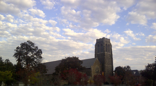


| North Facing Camera Click On Play Button To View Live Image |
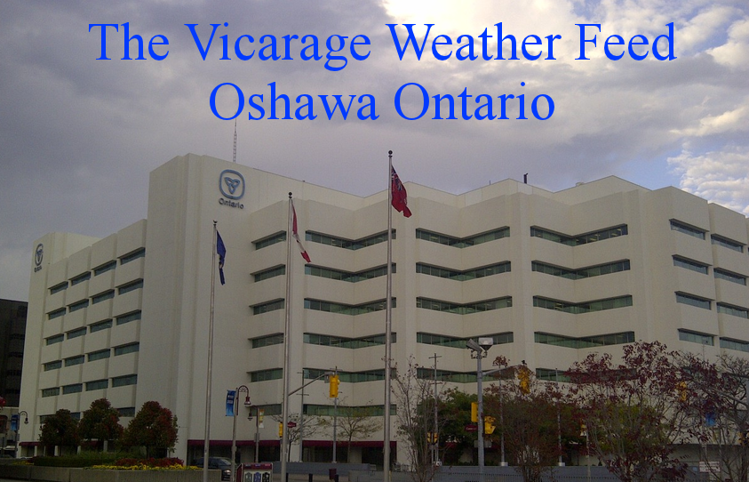
Sky Facing Camera Click On Image To View Full Screen In New Window 
|


NOAA-Style Climate Reports
Select a Year or Month report
2024: Jan Feb Mar Apr May Jun Jul Aug Sep Oct Nov Dec
2023: Jan Feb Mar Apr May Jun Jul Aug Sep Oct Nov Dec
2022: Jan Feb Mar Apr May Jun Jul Aug Sep Oct Nov Dec
2021: Jan Feb Mar Apr May Jun Jul Aug Sep Oct Nov Dec
2020: Jan Feb Mar Apr May Jun Jul Aug Sep Oct Nov Dec
2019: Jan Feb Mar Apr May Jun Jul Aug Sep Oct Nov Dec
2018: Jan Feb Mar Apr May Jun Jul Aug Sep Oct Nov Dec
2017: Jan Feb Mar Apr May Jun Jul Aug Sep Oct Nov Dec
2016: Jan Feb Mar Apr May Jun Jul Aug Sep Oct Nov Dec
2015: Jan Feb Mar Apr May Jun Jul Aug Sep Oct Nov Dec
2014: Jan Feb Mar Apr May Jun Jul Aug Sep Oct Nov Dec
2013: Jan Feb Mar Apr May Jun Jul Aug Sep Oct Nov Dec
Report for 2019 February
                   Monthly Climatological Summary for Feb 2019

Name: DW7240   City: Oshawa   State: Ontario, Canada
Elevation: 390 ft  Lat: N 43 53 48   Lon: W 078 52 26

                  Temperature (°C), Rain (mm), Wind Speed (km/h)

                                      Heat  Cool        Avg
    Mean                              Deg   Deg         Wind                 Dom
Day Temp  High   Time   Low    Time   Days  Days  Rain  Speed High   Time    Dir
----------------------------------------------------------------------------------
01 -13.7  -7.7   14:39 -20.2   07:00  30.9   0.0   0.0   1.0  20.9   00:07     W
02  -5.8  -0.3   19:35 -14.6   04:02  23.9   0.0   0.0   0.8  25.7   09:23     W
03   2.8   6.0   23:37  -1.0   00:26  15.5   0.0   0.2   0.6  22.5   23:40    SW
04   6.4   9.3   14:35   4.0   07:41  11.6   0.0   5.0   0.8  35.4   22:32   WSW
05   0.0   7.6   03:40  -6.3   22:14  18.3   0.0   0.2   5.3  40.2   10:08   NNW
06  -4.2  -1.8   16:05  -7.0   08:12  18.1   0.0   3.4   4.2  32.2   08:45   ENE
07  -1.9   2.8   23:22  -3.6   07:43  20.2   0.0   0.8   1.8  32.2   19:55     E
08  -2.3   5.1   02:43  -8.8   23:52  20.2   0.0   0.4  17.4  62.8   14:42   WNW
09  -6.1  -2.8   14:33  -9.1   03:56  23.6   0.0   0.4   8.0  38.6   02:31   WNW
10  -5.6  -2.2   13:53  -9.3   07:40  23.5   0.0   0.8   0.4  16.1   00:04    SW
11  -4.9  -2.6   15:28  -7.7   23:54  23.2   0.0   0.2   5.4  25.7   23:11   ENE
12  -6.9  -1.6   23:58  -9.4   04:09  25.2   0.0   0.6  14.6  49.9   13:28     E
13  -2.1   1.4   01:10  -4.6   18:28  20.4   0.0   5.2  11.7  51.5   02:17     W
14  -1.9   0.7   13:08  -4.7   01:44  20.2   0.0   0.4   3.5  27.4   19:12     E
15   0.8   3.6   10:52  -3.5   21:06  17.4   0.0   0.8   8.5  45.1   13:43     W
16  -5.5  -2.3   14:26 -10.2   23:58  23.5   0.0   0.0   5.3  32.2   03:26   NNW
17  -8.4  -5.2   13:58 -11.6   07:06  26.1   0.0   0.0   3.8  22.5   10:00   ENE
18  -9.9  -8.2   19:00 -11.6   23:58   5.6   0.0   0.0   4.8  22.5   21:42   NNW
19  -7.7  -5.3   19:34 -10.1   23:57   4.8   0.0   0.0   0.2   4.8   23:31     N
20  -4.5   0.0   23:59 -10.6   03:34  22.8   0.0   1.8  ----  41.8   13:45     E
21   1.8   3.9   15:16  -1.1   23:32  16.4   0.0   0.2  ----  35.4   08:56   WNW
22  -0.2   2.4   15:25  -3.4   23:54  18.0   0.0   0.0  ----  17.7   11:32    NW
23  -0.6   2.4   14:34  -4.9   04:48  18.8   0.0   0.0  ----  40.2   14:57     E
24   2.3   5.7   13:11  -1.4   23:59   8.4   0.0   4.4  ----  64.4   21:19     W
25  -4.1  -1.3   00:00  -7.0   23:53  22.4   0.0   0.0  ----  67.6   09:24   WNW
26  -8.9  -5.6   14:56 -11.7   23:55  27.2   0.0   0.0  ----  30.6   01:15   NNW
27 -11.8 -10.2   10:57 -13.1   21:25  30.1   0.0   0.4  ----  35.4   13:25   ENE
28 -10.3  -5.5   14:58 -16.7   06:20  28.2   0.0   0.0  ----  17.7   03:17     N
----------------------------------------------------------------------------------
    -4.0   9.3     4   -20.2     1   564.5   0.0  25.2   5.3  67.6    25      NW

Max >=  27.0  0
Max <=   0.0 16
Min <=   0.0 27
Min <= -18.0  1
Max Rain: 5.2 on day 13
Days of Rain: 17 (>= 0.2 mm)  4 (>= 2.0 mm)  0 (>= 20.0 mm)
Heat Base: 18.3  Cool Base: 18.3  Method: Integration
![[WOW]](WOW.gif)
![[Skywarn]](Skywarn.gif)

![[AWEKAS]](AWEKAS.gif)
![[CANWARN]](canwarn.png)
![[Weather Underground PWS IONOSHAW2]](https://dw7240.com/Base-Canada/wunderground.png)

![[WA]](WA.gif)
![[DAVIS]](DAVIS.gif)
![[anything]](ANYTHING.gif)
![[CoCoRaHS]](cocorahs_can.jpg)
![[MADIS]](MADIS.gif)
![[wcloud]](weathercloud.gif)
![[NOAARADIO]](ani-noaa-radio-small.gif)
![[NOAA]](NOAA.gif)
![[wxtogether]](weather_together.jpg)
![[ipcamlive]](IPCamLive.png)
![[ThingSpeak]](thingspeak.png)

![[MESOWEST]](MESOWEST.gif)
![[PWS]](PWS.gif)
![[COWN]](COWN.gif)
![[CWOP]](CWOP.gif)
![[WEATHERBUG]](WEATHERBUG.png)
![[WINDFINDER]](windfinder.gif)
