| North Facing Camera Click On Play Button To View Live Image |
Cam Image with Weather Conditions Overlay Click On Image To View Full Screen In New Window 
|
US Contiguous 48 States Snow Analyses
Choose Date:
| Year: | Month: | Day: |
Region Selectors

|
|
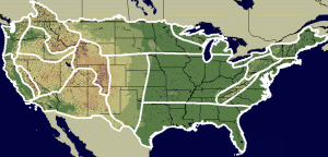
Click map area to select region or choose from dropdown |
National Snow Analyses for February 24, 2026
Snow Depth | Snow Water Equivalent | 24 Hr. Average Snowpack Temperature
24 Hr. Change Snow Water Equivalent | 24 Hr. Total Scaled Snow Precipitation
24 Hr. Snow Melt | 24 Hr. Blowing Snow Sublimation
24 Hr. Surface Sublimation | 24 Hr. Non-Snow Precipitation
(Mouse Over a Link to Display Map)
24 Hr. Change Snow Water Equivalent | 24 Hr. Total Scaled Snow Precipitation
24 Hr. Snow Melt | 24 Hr. Blowing Snow Sublimation
24 Hr. Surface Sublimation | 24 Hr. Non-Snow Precipitation
(Mouse Over a Link to Display Map)
Maps and Data Courtesy of NOAA NWS National Operational Hydrologic Remote Sensing Center
National Snow Analyses where past seasona from 2003 and Interactive Maps are available.
Script by SE Lincoln Weather.
National Snow Analyses where past seasona from 2003 and Interactive Maps are available.
Script by SE Lincoln Weather.


![[Skywarn]](Skywarn.gif)

![[WOW]](wow_be.jpg)
![[AWEKAS]](AWEKAS.gif)
![[CANWARN]](canwarn.png)
![[Weather Underground PWS IONOSHAW2]](https://dw7240.com/Base-Canada/wunderground.png)

![[WA]](WA.gif)
![[DAVIS]](DAVIS.gif)
![[anything]](ANYTHING.gif)
![[CoCoRaHS]](cocorahs_can.jpg)
![[MADIS]](MADIS.gif)
![[wcloud]](weathercloud.gif)
![[NOAARADIO]](ani-noaa-radio-small.gif)
![[NOAA]](NOAA.gif)
![[wxtogether]](weather_together.jpg)
![[ipcamlive]](IPCamLive.png)
![[ThingSpeak]](thingspeak.png)

![[MESOWEST]](MESOWEST.gif)
![[PWS]](PWS.gif)
![[COWN]](COWN.gif)
![[CWOP]](CWOP.gif)
![[WEATHERBUG]](WEATHERBUG.png)
![[WINDFINDER]](windfinder.gif)

