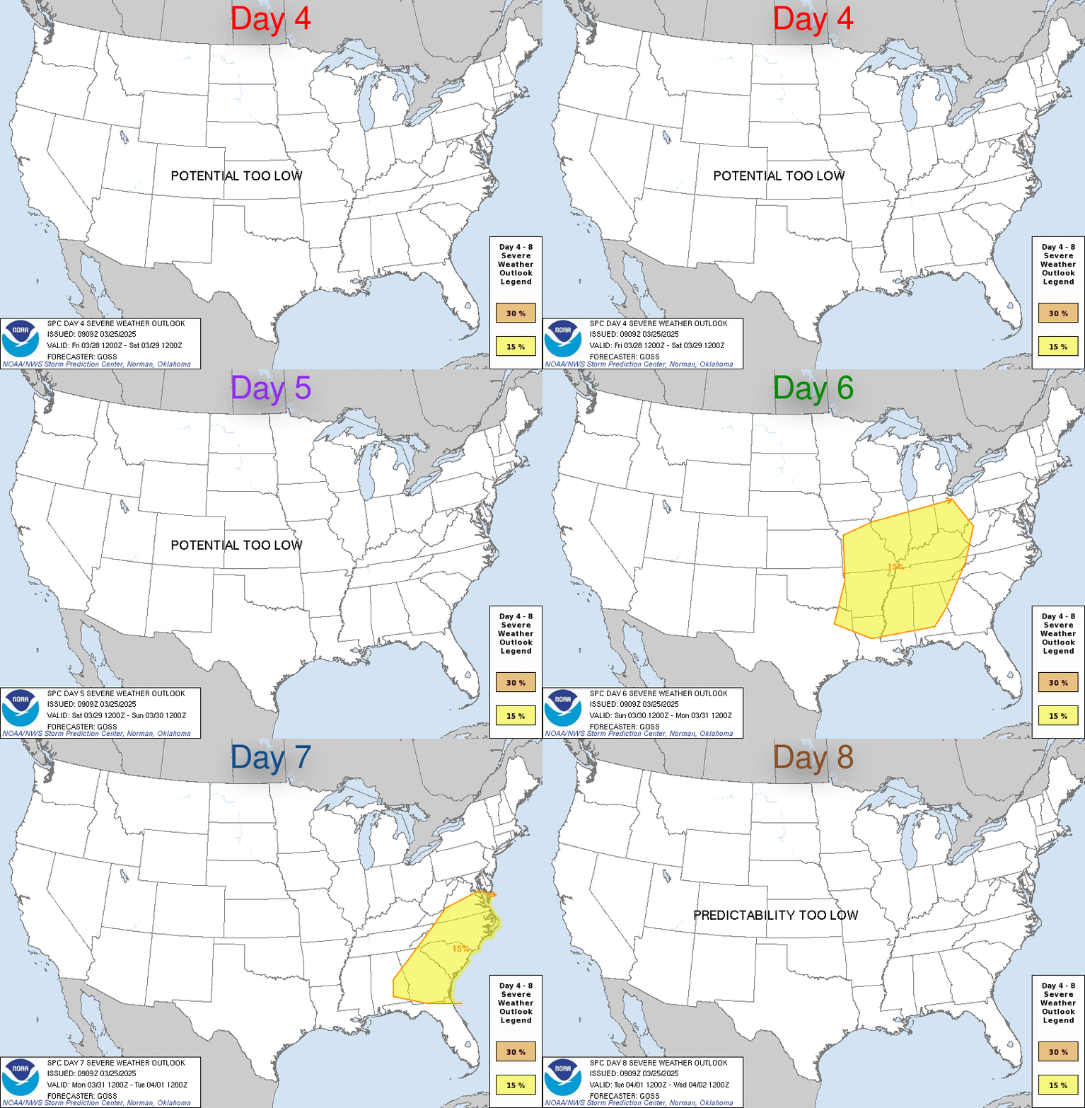
| Day 4-8 Severe Weather Outlook. A depicted severe weather area indicates a 30% or higher probability for severe thunderstorms within 25 miles of a point. |
| D4 | Sun, May 03, 2026 - Mon, May 04, 2026 |
D7 | Wed, May 06, 2026 - Thu, May 07, 2026 |
| D5 | Mon, May 04, 2026 - Tue, May 05, 2026 |
D8 | Thu, May 07, 2026 - Fri, May 08, 2026 |
| D6 | Tue, May 05, 2026 - Wed, May 06, 2026 |
(All days are valid from 12 UTC - 12 UTC) |
PREDICTABILITY TOO LOW is used to indicate severe storms may be possible based on some model scenarios. However, the location or occurrence of severe storms are in doubt due to:
- 1) large differences in the deterministic model solutions,
- 2) large spread in the ensemble guidance, and/or
- 3) minimal run-to-run continuity.
|
| POTENTIAL TOO LOW means the threat for a regional area of
organized severe storms appears highly unlikely during the entire
period (e.g. less than a 30% probability for a regional severe
storm area across the CONUS through the entire Day 4-8 period). |
Images courtesy of the NWS Storm Prediction Center
This data is offered only as a general guide to local weather conditions. It should not be relied upon in lieu of officially disseminated weather information for determining possible risk to persons or property.
This site, including all information contained therein, is made available as is without warranties of any kind, either express or implied.
The Vicarage Weather Feed© includes links to other sites for user convenience only.
The content of any linked third-party site is not controlled by The Vicarage Weather Feed©. Access to any third-party website through The Vicarage Weather Feed©, regardless of whether or not the third-party site is a linked site, is entirely at the users own risk.
Externally sourced content or material is excluded from The Vicarage Weather Feed© copyright and is the copyright and property of the respective provider.
Skywarn® and the Skywarn® logo are registered trademarks of the National Oceanic and Atmospheric Administration, used with permission.


![[Skywarn]](Skywarn.gif)

![[WOW]](wow_be.jpg)
![[AWEKAS]](AWEKAS.gif)
![[CANWARN]](canwarn.png)
![[Weather Underground PWS IONOSHAW2]](https://dw7240.com/Base-Canada/wunderground.png)

![[WA]](WA.gif)
![[DAVIS]](DAVIS.gif)
![[anything]](ANYTHING.gif)
![[CoCoRaHS]](cocorahs_can.jpg)
![[MADIS]](MADIS.gif)
![[wcloud]](weathercloud.gif)
![[NOAARADIO]](ani-noaa-radio-small.gif)
![[NOAA]](NOAA.gif)
![[wxtogether]](weather_together.jpg)
![[ipcamlive]](IPCamLive.png)
![[ThingSpeak]](thingspeak.png)

![[MESOWEST]](MESOWEST.gif)
![[PWS]](PWS.gif)
![[COWN]](COWN.gif)
![[CWOP]](CWOP.gif)
![[WEATHERBUG]](WEATHERBUG.png)
![[WINDFINDER]](windfinder.gif)

